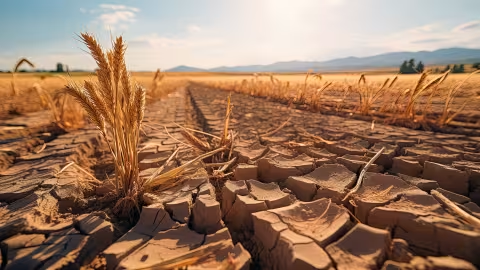
The effects of climate change on the water cycle are already evident across the country: reduced water availability—particularly due to recurring droughts—more intense weather events (cyclones, floods, etc.), and deteriorating water quality. In response to growing pressures on water resources, the Explore2 project has released updated findings incorporating the warming levels from the Reference Warming Trajectory for Climate Change Adaptation (TRACC).

In response to growing pressures on water resources, the Explore2 project—coordinated by the National Research Institute for Agriculture, Food, and the Environment (INRAE) and the International Office for Water (OiEau)—has released updated findings incorporating the warming levels from the Reference Warming Trajectory for Climate Change Adaptation (TRACC). This research, published in late 2025, outlines contrasting hydrological futures for France—some of which may present alarming trends—but also provides regions and stakeholders with extensive data and information to inform potential adaptation scenarios.
1- How might our water resources evolve under different possible futures?
Launched in 2021 with support from the Ministry of Ecological Transition and the French Office for Biodiversity (OFB), Explore2 aims to update our understanding of the impact of climate change on natural hydrology. The project covers mainland France and Corsica through the year 2100, based on the most recent publications from The project covers mainland France and Corsica through the year 2100, based on the most recent publications from the Intergovernmental Panel on Climate Change (IPCC), and has consolidated the latest hydro-climatic projections. By June 2024, the project’s results were already revealing alarming trends for the end of the century: wetter winters, drier summers, and more severe droughts.
In March 2023, France adopted the Reference Warming Trajectory for Climate Change Adaptation (TRACC), based on a warming of approximately +2 °C by 2030, +2.7 °C by 2050, and up to +4 °C by 2100, compared to pre-industrial levels, for mainland France. It establishes a common framework within which the actions of the government, local authorities, businesses, and citizens must be aligned to assess climate risks and adapt public policies, including water policies.
Following the work conducted between 2021 and 2024, the Explore2 project partners revisited the data analysis to align it with the TRACC. The goal is to provide local stakeholders with hydrological information differentiated by warming levels, taking regional specificities into account and offering hydrological narratives (stories of possible futures).
Analysis of the hydrological projections suggests that:
• Uncertainties remain regarding the changes and their intensities in terms of precipitation • Uncertainties remain regarding changes and their magnitudes in terms of annual and seasonal precipitation (increases or decreases in winter and summer, depending on location).
• Hydroclimatic variables are subject to natural variations resulting from natural climate variability, and these uncertainties must be taken into account. This means that year-to-year fluctuations may be observed: exceptional or extreme conditions, very wet years, or, conversely, very dry years.
• Heterogeneous groundwater recharge across the country: it is improving in the Northeast and declining in the Southeast.
• An increase in winter flow rates across the northern two-thirds of the country for a France at +2.7 °C (most projections between +10% and +25%), but only in one-third of the country for a France at +4 °C (most projections between 0% and +20%).
• A systematic decline in summer flow rates, regardless of the level of warming, with most projections showing a change between -10% and 0% for a France at +2.7 °C and around -20% (mostly between -30% and -10%) for a France at +4 °C.
• Projected hydrological droughts are expected to be more severe across three-quarters of the country. For a France at +2.7 °C, low-flow levels decrease by 15% (ranging from -25% to -10% depending on the region). For a France at +4 °C, low-water levels will decrease by about 30% (ranging from -40% to -20%), with more significant decreases in southern France. An increase in soil drought conditions has also been observed.
2- What is the practical significance of the Explore2 findings?
All of the Explore2 findings show that taking action to promote adaptation is urgent not only in regions already under stress but must also be anticipated for other regions that will gradually be affected by rising temperatures and the impacts of climate change, even though uncertainties remain regarding hydrological projections. It is essential to strengthen “no-regrets” and transformative adaptation measures to address the significant changes that will affect the entire water cycle in a France with temperature increases of +2.7°C and +4°C.
Explore2 data are recognized as reference data by all national and local stakeholders (government agencies, water agencies, local governments, consulting firms, economic actors, and civil society). It is useful in planning processes, particularly in water development and management plans (SAGE) and for prioritizing actions in regional water management projects (PTGE), as well as in local studies—for example, within the scope of specific economic basins.
Data from Explore2 supports forward-looking approaches to land-use planning and water management: it is useful for identifying regions’ vulnerabilities to climate change as they relate to water resources.
Explore2 data is recognized as a reference source for all national and local stakeholders (government agencies, water agencies, local governments, consulting firms, economic actors, and civil society). It is useful in planning processes, particularly in water development and management plans (SAGE) and for prioritizing actions in regional water management projects (PTGE), as well as in local studies—for example, those focusing on specific economic basin areas.
Explore2 data supports forward-looking approaches to land-use planning and water management: it is useful for identifying regions’ vulnerabilities to climate change as they relate to water resources and for planning the adaptation measures to be implemented.
3- How can you access the Explore2 results?
To facilitate adaptation efforts, several tools have been developed to access, understand, utilize, and apply the results, tailored to different needs and target audiences:
• The research repository hosts all technical and scientific documents produced during the project. It includes, in particular, the report on surface hydrology and the report on groundwater hydrology, analyzed according to the warming levels established by TRACC.
• The DRIAS-Eau portal (Météo-France), which allows users to download all hydrological projections, data, and indicators based on the TRACC model, as well as numerous guides for effectively interpreting the data and viewing a wide range of interactive maps showing trends in hydrological variables.
• An interactive MEANDRE portal (INRAE) that allows users to view projections by region, with a specific portal for viewing projections aligned with the TRACC framework (MEANDRE-TRACC).
• A free and openly accessible MOOC (register here) for training, with a new module released in May 2026 that explains the TRACC framework, methodology, use of narratives, results, and available tools. Completing this MOOC is strongly recommended to make the most of the Explore2 results.
• 187 fact sheets organized by hydrological sector and TRACC warming level (download here) detailing changes in flow rates, precipitation, and groundwater recharge by basin, accompanied by a guide to interpretation.
•
4- Overseas Territories to Be Covered Soon
A similar Explore initiative, involving several research institutes as well as water sector stakeholders, was launched in 2026 to cover the overseas territories (Guadeloupe, French Guiana, Réunion, Martinique, and Mayotte). It is supported by the Ministry responsible for the ecological transition. As a result, the overseas territories will have access to regional projections on changes in water resources to anticipate and adapt to the effects of climate change. These results will be based on climate projection data from the TRACC model, known as “Socle outre-mer,” which will be made available by Météo-France on the DRIAS portal by the end of 2025.
read more about Inrae : INRAE: research for Agriculture, Food and Environment
Published by Inrae on June 18, 2026